Precision Surveillance
Automated Inspections
Law Enforcement Support
NDAA Compliance
Innovative Partnerships
Partner Manufacturer: DeltaQuad
DeltaQuad's cutting-edge drone technology has revolutionized our operational capabilities. Their systems are not only reliable but also incredibly efficient, allowing us to conduct surveillance and inspections with unmatched precision.
The collaboration with DeltaQuad has significantly enhanced our service offerings. Their drones are equipped with advanced features that align perfectly with our mission to provide top-tier surveillance and inspection solutions.
Get in Touch for Expert Drone Solutions
At Lone Star Tactical Solutions Inc., we are dedicated to providing cutting-edge drone services tailored to your needs. Our team is ready to assist you in understanding how our advanced drone systems can enhance your operations. Contact us today to learn more or to schedule a consultation.
Frequently Asked Questions
Our drone applications are designed to enhance surveillance, streamline inspections, and support law enforcement efforts. Below, we address some common inquiries to provide clarity on how our services can meet your needs.
What types of surveillance can your drones perform?
1. Aerial Reconnaissance & Real-Time Video Feed
• Day/Night EO/IR Camera Systems for full-spectrum surveillance
• Live-streaming HD video with secure, encrypted data links
• Thermal imaging for heat signatures in low-visibility environments
What are the drones limitations
Tolerances:
Maximum takeoff/landing wind:
12.5 m/s = 27.96 mph
Maximum wind (cruise flight):
14 m/s = 31.33 mph
Maximum precipitation:
7 mm/h = 0.28 inches/hour (light drizzle)
Operating temperature range:
-20°C to +45°C = -4°F to 113°F
Maximum flight altitude AMSL:
5500 meters = 18,045 feet
How do your drones assist in infrastructure inspections?
Infrastructure & Asset Inspection
• High-resolution imaging for pipelines, powerlines, railways, bridges, and cell towers
• Automated route tracking with AI-enabled anomaly detection
• Supports federal mandates for critical infrastructure surveillance
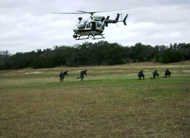
What is the role of drones in law enforcement support?
Border & Perimeter Monitoring
• Persistent surveillance of linear terrain, remote crossings, and high-risk zones
• Integration with geofencing, motion detection, and pattern-of-life analysis
• Designed to support CBP, DPS, and local LE patrol units
Tactical Intelligence, Surveillance & Reconnaissance (ISR)
• Pre-programmed mission routes with silent operation profiles
• Multi-platform synchronization with man-in-the-loop and autonomous modes
- Supports JTAC, SWAT, and Special Warfare coordination
- Counter UAS operation
- Swarm capable
- Comm relay platform for mesh networks
Are your drone systems compliant with NDAA regulations?
Civilian platforms have a General Export Authorization for exports to Australia, Canada, Iceland, Japan,
New Zealand, Norway, Switzerland, Liechtenstein, the United Kingdom and the United States of America.
Lone Star Tactical Solutions Inc. (LSTS) is exclusively working to ensure NDAA-compliance is obtained and that our drones become Blue UAS listed in the very near future. If interested in becoming our government sponsor email info@lonests.org today. We are registered with SAM.gov and are compliant and eligiable to bid on government contracts and to recieve government assitance/grants.
🔧 Why NDAA Compliance Matters for LSTS:
• Enables eligibility for U.S. government contracts, including:
• DHS, CBP, DoD, DOJ, FEMA, and state/local law enforcement agencies.
• Ensures cybersecurity, airspace integrity, and trustworthy ISR operations.
• Supports integration with federal and state C2 systems without red flags during acquisition vetting.
• LSTS can provide compliance documentation and origin traceability for all mission-critical drone components upon request.
🔐 Compliance Statement
All drone systems fielded by LSTS are either:
• -compliant, meaning:
• No components are sourced from prohibited entities (e.g., DJI, Autel, or Chinese-origin manufacturers listed under Section 889 of the FY19 NDAA).
• All communications modules, flight controllers, data storage units, and payloads are either U.S.-made or sourced from allied, vetted manufacturers.
• Firmware is free of backdoors or restricted code, and every aircraft undergoes a supply chain security vetting process.
• In partnership with vetted manufacturers, including DeltaQuad (EU-based) and U.S. component integrators to maintain Blue UAS pathway eligibility.
What kind of training do your operators receive?
Lone Star Tactical Solutions (LSTS) – Operator Training Overview
At LSTS, our operators are highly trained professionals with mission-specific certifications that ensure safe, effective, and compliant drone operations in tactical, law enforcement, infrastructure, and disaster response environments.
🛰️ Core Training & Certification
✅ FAA Part 107 Certification
All operators are licensed under FAA Part 107 for legal commercial drone operation in U.S. airspace. This includes:
• Airspace and sectional chart navigation
• Weather effects and NOTAMs
• Crew resource management and risk mitigation
• Remote ID and night operation endorsements
⸻
🛡️ LSTS Tactical UAS Operator Training
Tailored to our operational mission set, this includes:
• Thermal and EO/IR payload operations
• Low-visibility & covert surveillance tactics
• Target tracking and pattern-of-life observation
• Field integration with law enforcement and military elements
• Mission briefing and SALUTE-format reporting
⸻
🔧 Platform & Payload Technical Proficiency
📍DeltaQuad Operator Certification
All LSTS drone pilots operating DeltaQuad platforms receive formal certification directly through DeltaQuad’s proprietary systems training, which includes:
• Flight operations and advanced VTOL capabilities
• Failsafe protocols (autonomous return-to-base, battery/range failover, redundancy management)
• Payload integration and optimization (mapping sensors, EO/IR, LiDAR, multispectral)
• Ground control station use, live telemetry interpretation, and mission programming
• Maintenance, diagnostics, and firmware updates
Operators must pass DeltaQuad’s certification exam and complete hands-on scenario training for full mission approval.
📡 Advanced Training Modules (as required by contract scope):
• GIS/Photogrammetry
• Critical Infrastructure Assessment
• SAR/Urgent Response Protocols
• Evidence chain-of-custody for LE missions
• Secure data handling and airspace deconfliction
🔁 Ongoing Qualifications
• Quarterly live-flight proficiency checks
• System upgrades & re-certification
• Scenario-based joint drills with client agencies
What do you use for geospacial analysis?
Lone Star Tactical Solutions (LSTS) – Geospatial Analysis Toolkit
LSTS transforms aerial data into operational intelligence through an advanced geospatial analysis suite tailored for border security, critical infrastructure, surveying, search and rescue, and tactical ISR. Our approach fuses photogrammetry, LiDAR, and live telemetry to deliver accurate, layered, mission-ready mapping products.
⸻
🧭 Primary Geospatial Tools & Software
📍 Pix4D Mapper & Pix4Dreact
• Rapid 2D orthomosaic generation and 3D reconstruction
• Ideal for:
• Tactical site modeling
• Structural damage assessment
• Emergency response planning
• Compatible with EO, IR, and multispectral datasets
📍 QGIS (Quantum GIS)
• Open-source GIS engine used to:
• Fuse topography, hydrology, and infrastructure overlays
• Create mission layers with law enforcement or DoD-specific data
• Export to formats compatible with DHS, CBP, ATAK, and Palantir
📍 DeltaQuad Mission Control Suite
• Real-time telemetry, GPS tagging, and autonomous route planning
• KML/GeoJSON compatibility for importing shapefiles and geofenced zones
• Supports live route editing, deviation alerts, and POI logging
⸻
🛰️ LiDAR-Based 3D Multi-Layer Mapping
For missions requiring ultra-high-resolution terrain data, LSTS deploys LiDAR payloads capable of:
• 3D terrain reconstruction with centimeter-level accuracy
• Vegetation penetration for canopy analysis and undergrowth mapping
• Change detection across time-series flights
• Infrastructure grading, elevation modeling, and drainage analysis
This data is layered with:
• EO imagery
• Thermal signatures
• Man-made structure classification (e.g., fences, utility lines, rooftops)
⸻
🔒 Secure Data Processing & Export
• Cloud or local processing via secure, air-gapped workstations
• Deliverables include:
• GeoTIFF / DSM / DTM
• LAS/LAZ point clouds
• Shapefiles (SHP)
• KMZ overlays for ATAK & Google Earth
• Compatible with:
• ArcGIS
• Palantir
• ATAK
• DHS and DoD GIS tools
🔄 Operational Workflow
1. Flight Planning – Using GCS + GIS overlays
2. Data Collection – Drone imagery + LiDAR scanning
3. Processing Phase – Automated stitching, point cloud generation, terrain filtering
4. Analysis – Terrain, structure, and anomaly tagging
5. Product Delivery – Layered map output to client-defined specifications
Proven Impact of Our Drone Technology
95%
of clients report improved operational efficiency after integrating our drone systems into their surveillance and inspection processes.
Enhanced Surveillance Accuracy
98%
accuracy in identifying potential threats during law enforcement operations, significantly reducing false positives.
Inspection Time Reduction
70%
decrease in time required for infrastructure inspections, allowing for quicker maintenance and response times.
Discover the Difference
Trusted Partnerships in Drone Applications
Lone Star Tactical Solutions Inc. has proudly collaborated with esteemed organizations such as Texas DPS, SRT, Texas Rangers, TMU, CBP, Flex Teams, BoreTac, and BoreStar across the Rio Grande Valley. Our partnerships reflect our commitment to providing advanced drone solutions tailored for law enforcement and infrastructure inspection needs.
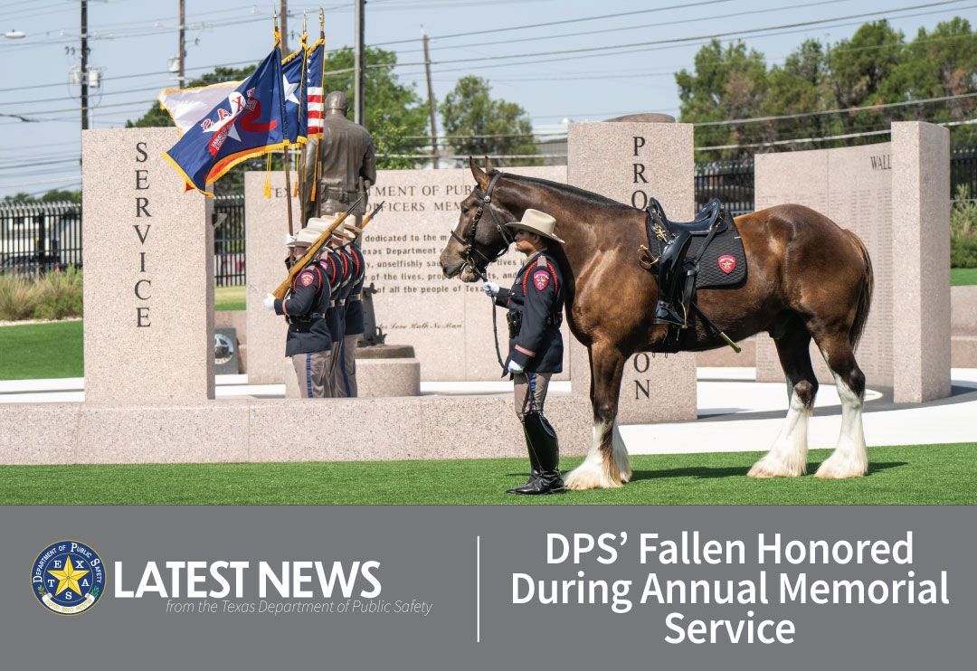
Texas DPS Collaboration
Working alongside Texas DPS, we have enhanced surveillance capabilities, ensuring public safety and effective law enforcement operations throughout the state.
Support for Texas Rangers
Our partnership with the Texas Rangers has enabled us to deliver critical support during investigations, improving situational awareness and operational efficiency.
Collaboration with CBP
By collaborating with Customs and Border Protection, we provide advanced tactics that aids in border security and surveillance, ensuring the safety of our communities.